Map Labelling Worksheet (Free Printable PDF)

An invented island on a lettered grid, with numbered markers to identify and a key table where each one gets a name and a grid reference.
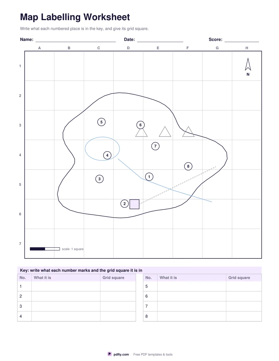
Printable map labelling worksheet with a numbered outline map and key table
Numbered markers
Paper size
Fill & edit free online

Free · no watermark · no sign-up for your first 20 downloads a day

Fillable PDF — type into the fields online or in any PDF viewer before printing.

The map is an imaginary island rather than a real country, which means it tests map skills instead of memory and can be used in any country's classroom. It is drawn with a coastline, a lake, a river running to the sea, a range of hills, a settlement and a road, all as plain shapes, on a grid lettered A to H across and numbered down the side so every feature has a grid reference.

Numbered markers sit next to the features, eight or twelve of them depending on the option. Underneath, a key table lists those numbers with a column for what each one is and a column for its grid square. The teacher decides what the numbers mean, so the same sheet can be a lesson on physical features one week and on grid references or compass directions the next.

The frame carries a north arrow and a scale bar of one grid square, which gives a way to ask how far it is from the town to the coast or which direction the river flows. Every cell of the key table is a form field, so the sheet works on a tablet as well as on paper, and it fills the page on both US Letter and A4.
How to use it

  1. 1

    Choose how many markers

    8 markers for a first lesson, 12 when you want more features named.

  2. 2

    Decide what the numbers mean

    Tell the class which feature each number marks, or let them name what they can see.

  3. 3

    Print or fill it in

    Print at 100% ("Actual size") so lines and boxes keep their exact spacing, or fill the form fields on screen in any PDF viewer.

  4. 4

    Fill in the key

    Write what each number marks and the grid square it sits in, using the letters across the top and the numbers down the side.

Frequently asked questions

Yes. There is no watermark and no sign-up for your first 20 downloads each day; after that a free account keeps downloads going. You may print the file as often as you like for personal, school or business use.
No. The island is drawn from simple shapes, so the worksheet tests map reading rather than recall of a particular map.
A coastline, a lake, a river, hills, a settlement and a road, plus a north arrow and a scale bar of one grid square.
Columns are lettered A to H across the top and rows are numbered down the side, so a square is named like C4.
Yes. Every cell of the key table is a form field, so the sheet can be completed on screen.
Yes. The grid, the north arrow and the scale bar make it usable for grid references, directions and simple distance questions.

More free templates

Work with your PDF